They’re gone at last!

It seems every time we have my wife’s family over, it’s like having a tornado blow through the apartment. Her parents come, her brother brings his small village over, they stay for a day or two, run us all over the place and then vanish, leaving a trail of destruction. Her brother’s mother-in-law does the dishes for us though, which is nice.

Proud parents posing with the future physician after yesterday’s White Coat Ceremony.
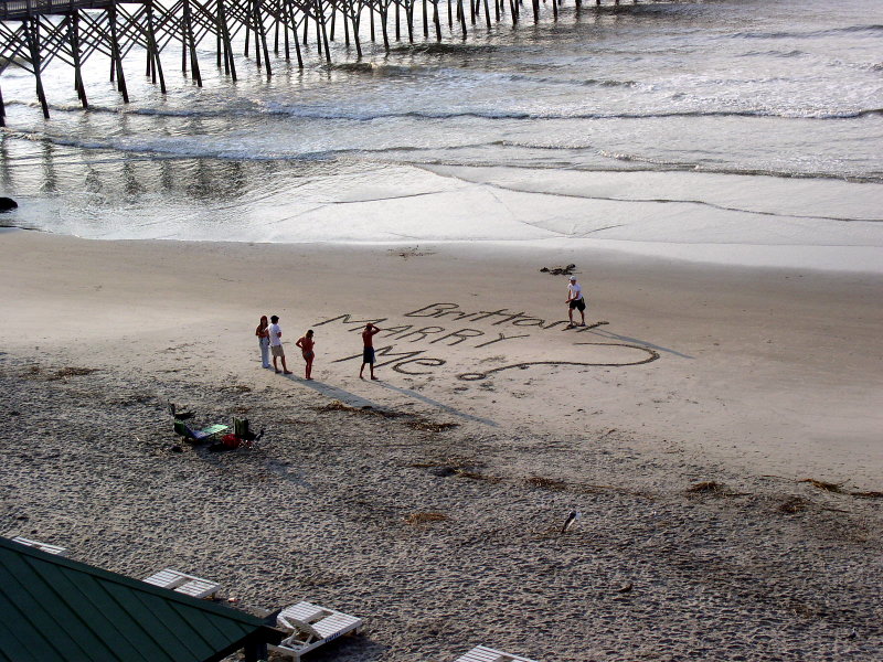
Wonder if she said yes

An interesting way to propose.

A marriage proposal written in large letters in the sand at the beach

Spotted on Folly Beach in front of the hotel this morning.

Wave at the storm as it passes

Charley is passing by just off the coast as I write this. Last report had it about 50 miles or so just southeast of Charleston. It’s been pretty windy and rainy for the past few hours, but that’s about it. Heavy rain bands that passed by us a little while ago are hitting the Mt. Pleasant area and areas further north. I expect the worst of the rain will be over fairly soon, and the wind will die down in the next hour or two.
Then it will be time to keep an eye on TD5. NHC has it turning into a tropical storm later on this weekend, perhaps by tomorrow, in which case we’ll have Tropical Storm Earl to keep tabs on.
In the meantime, TD 4 has turned into Tropical Storm Danielle overnight. Looks like Danielle will probably stay out in the Atlantic and not affect any land though.

Hey, one at a tme, no need to rush

TD4 has started warming up and we now have TD5 gearing up in the same area that sprouted Charley. If this keeps up I’ll need to develop chameleon eyes to keep track of all this activity.
Sometime tomorrow morning Charley will be brushing uncomfortably close to Charleston on it’s way to another landfall in the Georgetown area. Hopefully there is no additional strengthening when it’s over the Atlantic after it leaves Florida

And waiting on deck…

Number 4 you’re up to bat! Fresh from the NHC is news about Tropical Depression 4 getting warmed up in the eastern Atlantic.

AT 11 AM AST…1500Z…THE CENTER OF TROPICAL DEPRESSION FOUR WAS LOCATED NEAR LATITUDE 12.2 NORTH…LONGITUDE 22.7 WEST OR ABOUT 275 MILES… 445 KM…SOUTH-SOUTHEAST OF THE CAPE VERDE ISLANDS.
THE DEPRESSION IS MOVING TOWARD THE WEST NEAR 14 MPH…22 KM/HR… AND THIS GENERAL MOTION IS EXPECTED TO CONTINUE FOR THE NEXT 24 HOURS
MAXIMUM SUSTAINED WINDS ARE NEAR 35 MPH… 55 KM/HR…WITH HIGHER GUSTS. SOME STRENGTHENING IS FORECAST DURING THE NEXT 24 HOURS… AND THE DEPRESSION COULD BECOME A TROPICAL STORM LATER TODAY OR TONIGHT.

This one will definitely require some watching for those on the East coast.